In The Flow of Time – August 29, 2024
The compass rose, what else is there? Well, street numbers of course. There are alternatives.
On the Hawaiian islands, the central part of each island is higher (volcanoes), sloping down toward the sea. So directions are based on that geographic reality. Makai means toward the sea. Mauka means toward the mountain. If you’re moving along a road, you come to a cross street. Do you go right or left? Well, actually it could be either, depending on your direction. But makai is always unambiguous. When you get here, turn toward the sea.
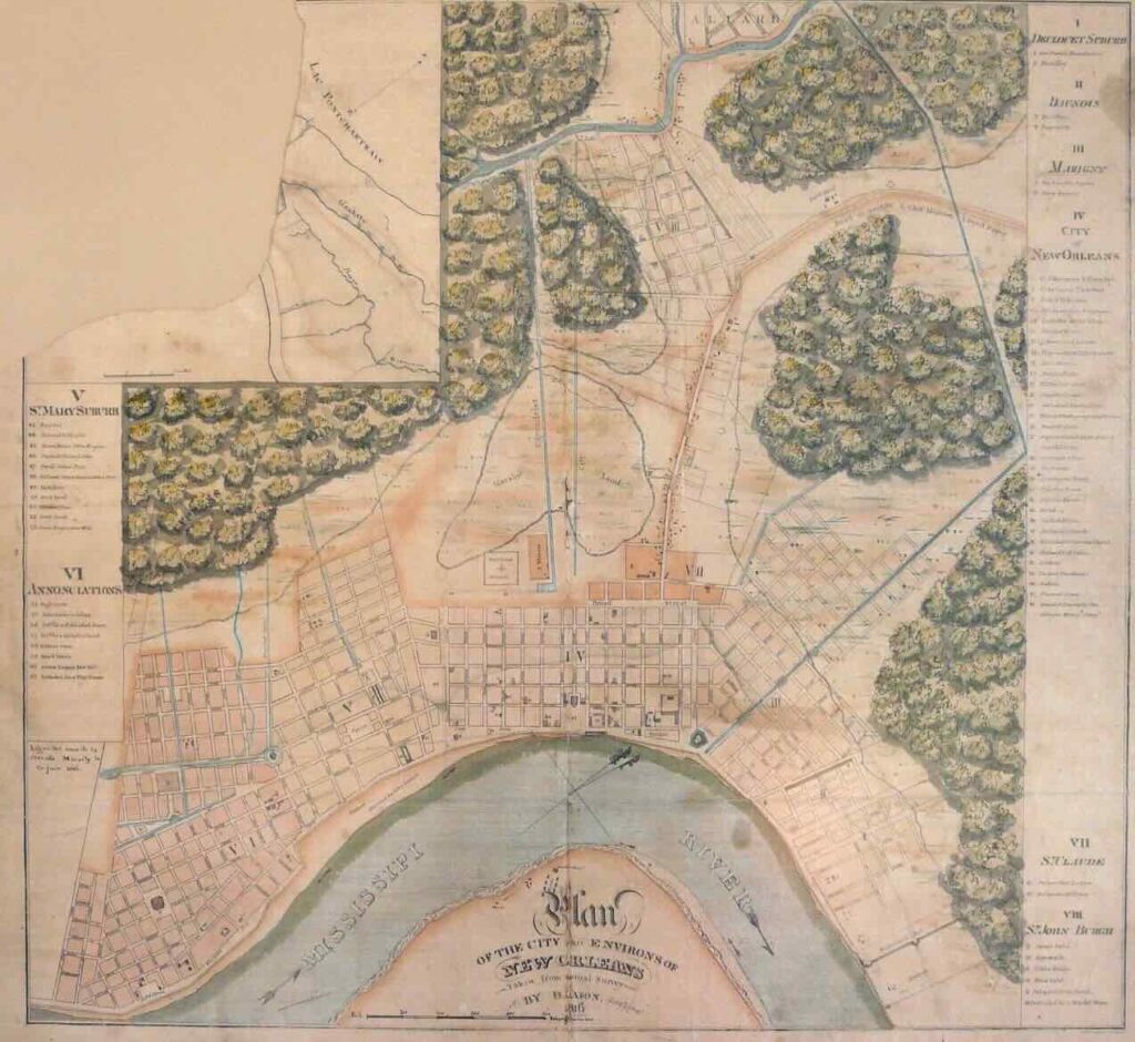
New Orleans occupies land between the Mississippi River and Lake Pontchartrain. The roads were laid out in a grid, some ran along the river, some ran away from the river. So, there are four directions, and they all relate to the river. They are, riverside, lakeside, downtown, and uptown. In this system, a location might be described as the lakeside of Dauphin, between Orleans and St. Ann. Or uptown St. Ann, between Rampart and Burgundy. Uptown and downtown in New Orleans refer to the flow of the Mississippi River. The direction “lakeside” meant “away from the river” so it was useful throughout the city, regardless of the street’s orientation.
Modern day, “uptown” as one word refers to a classier part of a city. I’m not sure, but I suspect that meaning derives from New Orleans. In the early 1800s Americans began building the fancier part of New Orleans uptown. The direction up town became uptown. “Uptown” as a word dates to about 1800, which fits my hypothesis. The flatboat landings were uptown, and those were decidedly NOT classy.
There are street numbers. They’re a mess. The city had original street numbers, and then it was renumbered, three times. I found a good site that translates the modern numbering system to approximately which numbers were on which blocks back in 1859. But there is an even older numbering system. I have some of the original numbers from various documents. If that’s not bad enough, they swapped odd and even. Back in the day, riverside and uptown were odd numbers. Today they are even numbers.
For example, in 1822 Marie Laveaux’s house is listed at 57 St. Ann Street. Then in 1823 it’s #179. In 1859 they renumbered the city again. It becomes #152. And later they standardized block numbering. By then the house was gone, but where it was is now numbered 1020-1022.
Even my pedantry has limits. NOPE, not going there. I’ll use the river-based direction system. It’s the geographic reality, and local color.